Official tourism website for Fermanagh Lakeland Tourism
En

Belmore Forest: Pollnagollum Cave Walk

Boho Road, Coolarkan, Derrygonnelly, Fermanagh, BT74 5BF
Pollnagollum Cave Walk

Book Tickets Online

About

Belmore Forest covers much of Belmore Mountain with a summit of roughly 398m and is the second highest point in Fermanagh, providing breathtaking views of Boho, Lower Lough Erne, Lough Navar and to the east, Brougher Mountain with its distinctive television masts on top.

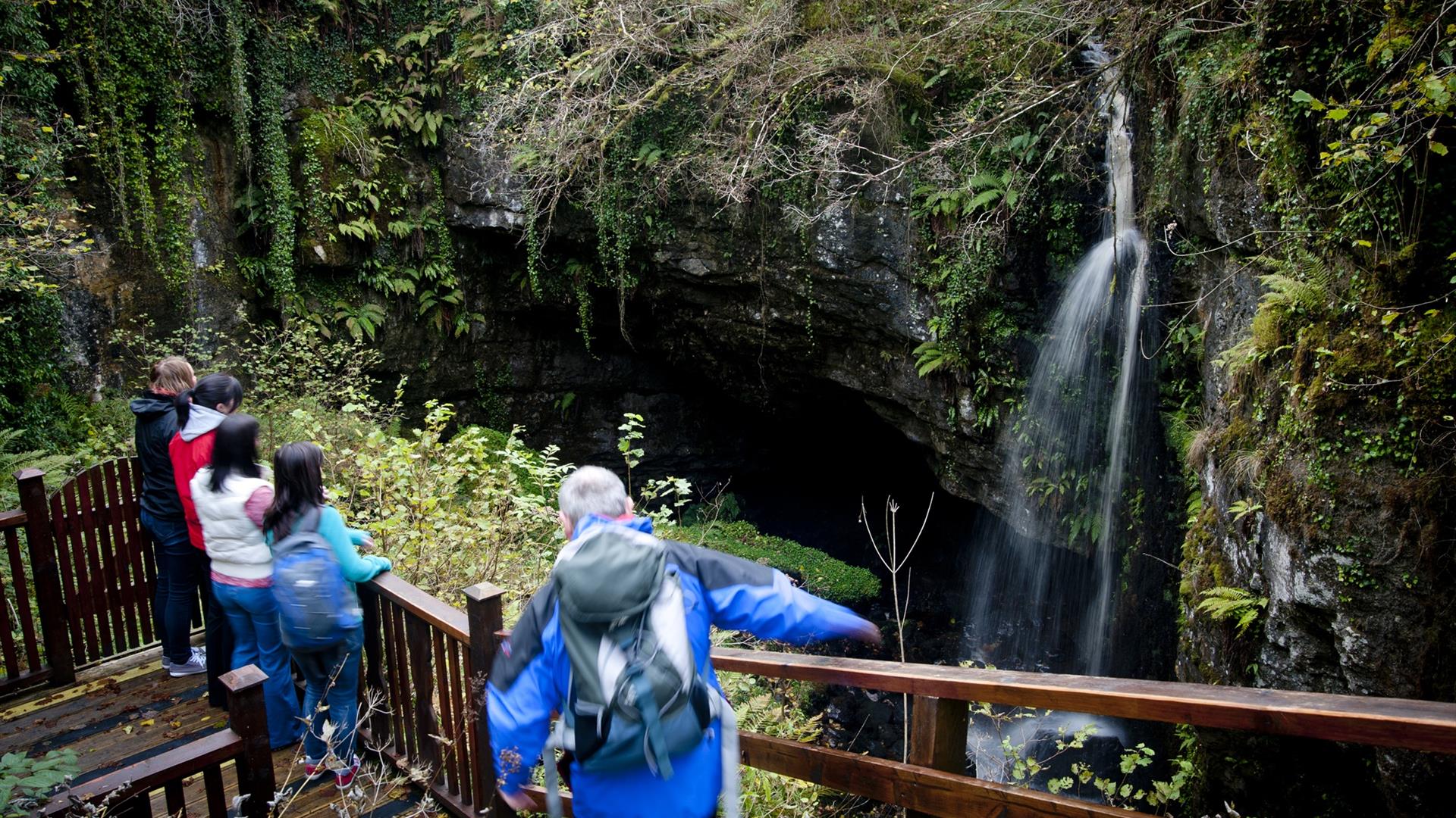
This wonderful expanse is at the heart of Fermanagh’s Boho cave country and beneath your feet lies an extensive maze of caves which attract cavers and potholers from far and wide. The forest is brimming with things to do: breath-taking views, local wildlife, deep forest, and cave systems; amongst them Pollnagollum Cave, which was used in filming for the popular television series, Game of Thrones. A viewing platform at Pollnagollum Cave provides a stunning vantage point to see the impressive cave entrance which is fed by a beautifully cascading waterfall toppling down a 12m limestone cliff to disappear into the depths of darkness. The stream flows underground for approximately 1.8km before resurfacing along the North bank of the Aghanaglack River.

WALK:

The first part of the walk passes Coolarkan Quarry on your left. Shortly after the quarry, a path branches off the track on your left and directs you down stone slab steps, to an observation platform that provides a safe access point for viewing the cave entrance and 12m waterfall. The walk resumes along the forest track, meandering uphill it offers spectacular views over the surrounding area including Cuilcagh Mountain, Lower Lough MacNean to the South and Brougher Mountain to the East.

Distance: 4.5 miles / 7km

Time: 2 hours

Grade: Easy

Terrain: All types, but mostly forest track and surfaced footpaths

Route: Anti-clockwise circular

Wheelchair accessible: No

Facilities: Carparking, on site interpretation, way marked walking route

Map: Discoverer Series OSNI Sheet 17 Lower Lough Erne

Dogs: Dogs must be kept under control and waste disposed of

Facilities

Provider Preferences

  • Free (parking charges may apply)

Map & Directions

What's Nearby

  1. Built for Malcolm Hamilton and completed in 1618, it has a Scottish look about it, with…

    4.62 miles away
  2. The Cladagh Glen, located in the Cuilcagh Lakelands Geopark, is a stunning walk providing…

    5.49 miles away
  3. Marble Arch Caves- Magical, Unique and Memorable. The Marble Arch Caves is a major…

    5.51 miles away
  1. Cuilcagh Lakelands UNESCO Global Geopark is located in the rugged mountainous uplands and…

    5.78 miles away
  2. Portora Castle guards a former crossing point where the river joins Lough Erne. Built in…

    6.36 miles away
  3. Florence Court is a truly welcoming home. The house, formerly the home of the Cole…

    6.49 miles away
  4. Fermanagh Genealogy Centre are a charitable organisation run by volunteers who assist…

    6.51 miles away
  5. Famous for its perfect 12th-century round tower and ruined Augustinian abbey, Devenish…

    6.7 miles away
  6. A visit to The Inniskillings Museum at Enniskillen Castle is a journey through more than…

    6.84 miles away
  7. Situated beside the River Erne in County Fermanagh, was built almost 600 years ago by…

    6.88 miles away
  8. A trip to Headhunters Barber Shop & Railway Museum is like taking a remarkable journey…

    6.98 miles away
  9. Visit Frances Morris in her studio/gallery to view the latest exhibition of her Irish…

    7.1 miles away
  10. Try to find the time to visit Jo Tinney Studio. Jo’s paintings in watercolour, pastel and…

    7.14 miles away
  11. Forthill Park is a pleasantly wooded town park with walks, shrub gardens and children's…

    7.34 miles away
  12. This fortified house and bawn are set on Tully Point and were built for Sir John Hume who…

    8.26 miles away
  13. Castle Coole one of Ireland's finest Neo-classical houses, allowing visitors to glimpse…

    8.59 miles away
Previous Next

Virtual Tour

Map & Directions

Road Directions

From Enniskillen, follow the A46 Shore road to Belleek. Take the left fork onto the B81 Derrygonnelly road and take the first road signed for Boho on the left. Continue along this road for approximately 4 miles, passing Boho Community Centre on the way before turning left at the sign for Belmore Forest. Continue up the forestry road, arriving at a small car park situated on your right. From Belcoo, head towards Enniskillen and turn left onto the road signposted for Boho. Continue until reaching a T-Junction and turn right. Then approximately 200m along this road turn left following the signs for Boho. Continue along this road for approximately 5km and turn right, there is a wooden sign for Belmore Forerst and continue up this lane until you arrive at a parking bay with Interpretation panel. There is a wooden sign on the road, indicating where to turn off for the walk.

Public Transport Directions

Translink - journeyplanner.translink.co.uk

Back to Top

Tourism Northern Ireland

Fermanagh and Omagh District Council

Enniskillen Island Town

Experience Enniskillen

Cuilcagh Lakelands Geopark

Don't Miss